Ce site web utilise des cookies pour améliorer votre expérience. Nous supposerons que cela vous convient, mais vous pouvez vous désabonner si vous le souhaitez. Lire la suite

summary
ToggleThe Maratrail 42 is a sporting event aimed at trail running enthusiasts. It offers them a unique experience in the high mountains, on a marked trail that starts at the Porté Puymorens resort and ends at Formiguères. This trail is the same as the first section of the Ultra Trail/Ultra Randonnée 220.
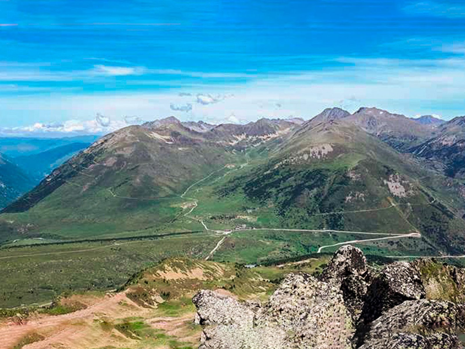
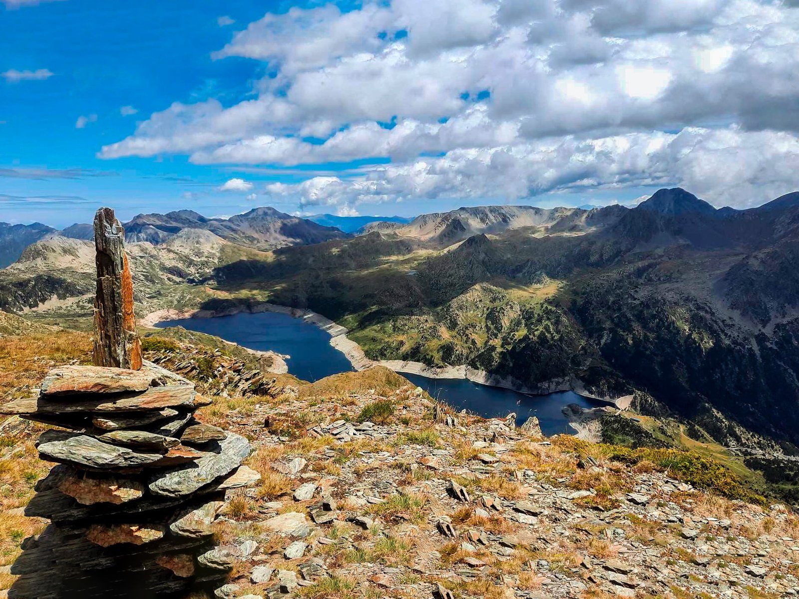
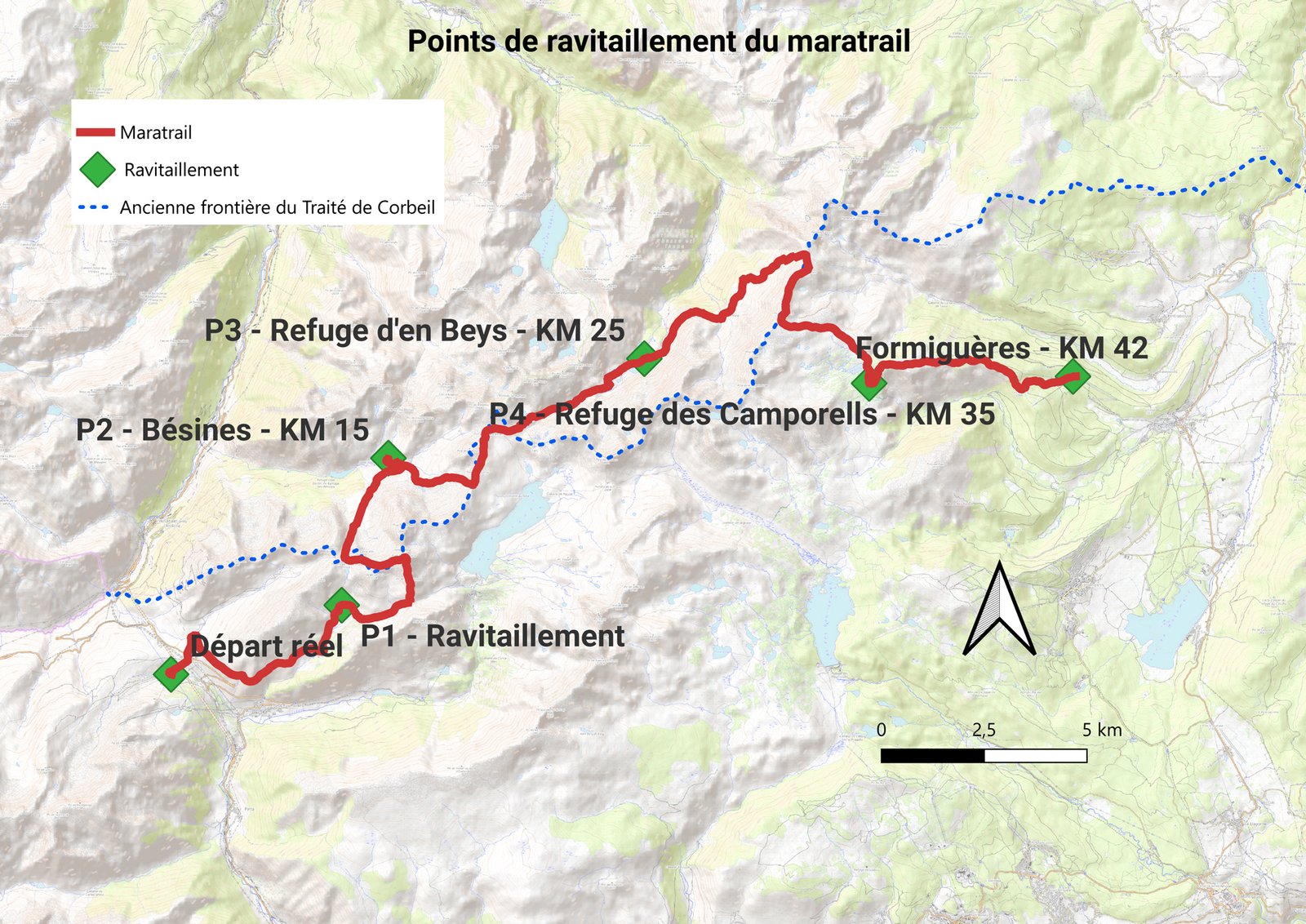
After reaching the summit of Puig Coma d’Or (2,800 m), offering breathtaking views of Andorra, Lanoux and the Carlit massif, runners will continue their adventure in Ariège, where they will join the GR Pays du Tour des Pyrénées from the Bésines refuge. They will then head towards the En Beys refuge to return to the Pyrénées Orientales and refuel at the Camporells refuge before the final stretch towards Formiguères.
This 42-kilometre route with 2,320 metres of elevation gain and 2,430 metres of elevation loss is highly demanding and requires appropriate preparation.
Discover this trail of 41.2 km which starts at Porté-Puymorens and ends at Formiguères. This route takes 32 km of paths and 8.4 km of forest trails. It has a cumulative climb of more than 2700m.
This 42 km trail with 2,320 metres of elevation gain takes place in the high mountains. It is difficult and technical. It passes through sections at over 2,400 metres altitude and the highest point is at 2,826 metres.
It connects the resorts of Porté Puymorens and Formiguères on the first section of the 220 format. It mainly follows the GR Pays du Tour des Pérics trail, passing through the Ariège department.
There are three refreshment points along the route.
Ce site web utilise des cookies pour améliorer votre expérience. Nous supposerons que cela vous convient, mais vous pouvez vous désabonner si vous le souhaitez. Lire la suite